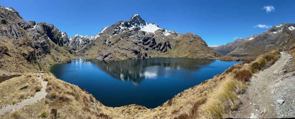
The Routeburn Track is one of New Zealand's 10 Great Walks and arguably the most spectacular. Stretching 33 km across the Southern Alps between Mt Aspiring National Park and Fiordland National Park, the Routeburn packs more variety into 2-3 days than most multi-week treks anywhere in the world. Beech forest, alpine tarns, hanging valleys, snow-capped peaks, waterfalls, and views that genuinely defy description. The photos throughout this page are from one of our contributors who recently completed the track and kindly shared their images.

Why the Routeburn Is Special
The Routeburn is the only Great Walk that crosses two national parks — starting in Mt Aspiring National Park and finishing in Fiordland. This means you walk through dramatically different landscapes in a single trip: dense beech forest at the lower elevations, then sub-alpine tussock and tarns above the bushline, then back into ancient mossy rainforest as you descend the Hollyford side. Most trampers will tell you the Routeburn has the highest proportion of "wow" moments per kilometre of any NZ Great Walk.
The track tops out at the Harris Saddle (1,255m) with an optional side trip up Conical Hill (90 minutes return) for panoramic views that on a clear day stretch to the Tasman Sea. You'll cross numerous swing bridges, walk past alpine waterfalls, and pass through some of the most pristine native bush left in New Zealand.

The Direction Debate
The Routeburn is a point-to-point track — you start at one end and finish at the other, then need transport back. Both directions are popular and there's no "wrong" way, but they offer different experiences:
Routeburn Shelter (Glenorchy end) → The Divide: The most popular direction. You start with the steady climb up the Routeburn Valley, spend night 1 at Routeburn Flats or Routeburn Falls, cross Harris Saddle on day 2, then descend into the Hollyford. Generally considered the more dramatic build-up because the climb to Harris Saddle is the highlight on day 2.
The Divide → Routeburn Shelter: Less crowded direction. Starts with the long climb up to Lake Mackenzie via Earland Falls, then traverses Harris Saddle on day 2 before descending the Routeburn Valley. The advantage is you get the alpine views earlier in the trip.
If you can't choose, go Glenorchy to Divide. It's the classic direction.

Booking the Routeburn — How to Get a Spot
This is the part that catches most people out. The Routeburn during Great Walks season (late October to early May) is incredibly popular and bookings sell out fast. Here's how the system works:
Bookings open in early May for the following Great Walks season (which starts in late October). The Department of Conservation (DOC) releases all hut spaces at once on a single day. Peak dates (December–February) sell out within minutes, especially for the more popular Routeburn Falls Hut. Shoulder season (October-November and April-May) has more availability.
How to book successfully:
- Create a DOC account at bookings.doc.govt.nz well in advance
- Save your card details and traveller details so you can book quickly
- Be online and logged in before bookings open (the exact date is announced on the DOC website each year)
- Have multiple date options ready in case your first choice is gone
- Book in this order: Routeburn Falls (most popular), Routeburn Flats, Lake Mackenzie, Lake Howden
Cost: Hut fees are around $140 per person per night for international visitors during Great Walks season ($102 for NZ residents). A 3-day, 2-night trip costs roughly $280pp in hut fees alone, before transport and gear.
The Huts
The Routeburn has four DOC huts during Great Walks season, each with bunks (no bedding — bring your own sleeping bag), gas cookers, running water, flush toilets and a warden. You sleep in shared bunkrooms with up to 48 other trampers.
Routeburn Flats Hut (20 bunks, 6.5 km / 2-3 hours from Routeburn Shelter) — the lower of the two Routeburn huts. Sits at the edge of an open grassy flat with great mountain views. Less popular than Routeburn Falls, so often easier to book.
Routeburn Falls Hut (48 bunks, 8.8 km / 4-6 hours from shelter) — sits dramatically perched above the Routeburn Falls with views down the valley. The most popular hut and the hardest to book. The waterfall right outside is spectacular at dawn and dusk.
Lake Mackenzie Hut (50 bunks) — sits beside the stunning Lake Mackenzie in a hanging valley below Emily Peak. Probably the most photogenic of the huts. Often where night 2 lands if you're walking Glenorchy to Divide.
Lake Howden Hut (28 bunks, 8.6 km / 3-4 hours from The Divide) — the closest hut to The Divide trailhead. Smaller and quieter than the others. Always check current status with DOC as it has had periods of closure.

Day-by-Day Walking Guide (Glenorchy to Divide)
Day 1: Routeburn Shelter to Routeburn Falls Hut (8.8 km / 4-6 hours)
The track starts at the Routeburn Shelter at the end of the road past Glenorchy. You begin with an easy walk through silver beech forest along the Routeburn River, crossing several swing bridges. After about 6.5 km you reach Routeburn Flats Hut in a beautiful open meadow.
From Routeburn Flats, the track climbs more steeply for the next 2.3 km through bush, with the river running below in a series of cascades. You'll arrive at Routeburn Falls Hut with the spectacular Routeburn Falls roaring just below the hut. Drop your pack, take photos, then explore the falls area before dinner.

Day 2: Routeburn Falls Hut to Lake Mackenzie Hut (11.3 km / 4-6 hours) — THE BIG DAY
This is the highlight day. The track climbs steeply out of the bush, through alpine tussock and tarns to Harris Saddle (1,255m). The view from the saddle is one of the great moments in NZ tramping — a panoramic sweep of the Darran Mountains, the Hollyford Valley below, and on a clear day, the Tasman Sea in the distance.
Side trip recommendation: If conditions are good, take the Conical Hill side trip (90 minutes return, 290m climb). The 360° view from the top is even better than the saddle and is widely considered the single best view on any Great Walk.
From Harris Saddle, the track sidles around the Hollyford Face — a stunning section with sheer drop-offs (the track is wide and safe but feels exposed) — before descending to Lake Mackenzie Hut. The descent through ancient beech forest beside the lake is magical.

Day 3: Lake Mackenzie to The Divide (12 km / 4-6 hours)
The final day descends through some of the most beautiful native rainforest you'll see in New Zealand. Highlights include the spectacular Earland Falls (174m, you'll get sprayed walking through the mist) and The Orchard — a flat clearing of ancient ribbonwood trees that look like an enchanted forest.

You'll pass Lake Howden Hut partway through (good lunch stop), then continue down to The Divide on the Te Anau-Milford Road, where buses pick up trampers throughout the day.

Transport Logistics
Because the Routeburn is point-to-point, transport logistics are the trickiest part of planning the walk. Your options:
Option 1: Bus shuttle (most common) — Several companies run shuttle services from Queenstown or Te Anau to either trailhead. Info & Track, Trackhopper, and Tracknet are the main operators. Typical cost: $80–$150 per person each way. Most trampers leave their vehicle in Queenstown, take the shuttle to the Routeburn Shelter, walk to The Divide, then catch another shuttle back to Queenstown via Te Anau.
Option 2: Self-drive + relocation service — Some companies will collect your car from the start and drive it to the end of the track for you. Convenient if you have lots of gear, expensive ($200+).
Option 3: Helicopter — Yes, really. Helicopter transfers take roughly 20 minutes vs 4+ hours by road. Around $300–$500 per person depending on numbers. Spectacular flightseeing as a bonus.

Fitness, Difficulty & Hazards

The Routeburn is rated Intermediate by DOC. This means it's suitable for people of average fitness with some hiking experience, but it is genuinely challenging in places. You'll be carrying a 12-15 kg pack, walking 4-6 hours per day, and climbing significant elevation on day 2. The track is well-formed and signposted throughout, but the physical effort is real.
If you can comfortably walk for 5-6 hours with a full pack and have done at least one long day hike previously, you'll manage the Routeburn. If you've never carried a multi-day pack before, do at least 2-3 training walks with a loaded pack before you commit.
Hazards to know about:
- Weather changes fast. Even in summer it can snow on Harris Saddle. Always carry warm layers and a waterproof jacket.
- Sandflies. These tiny biting insects are everywhere in Fiordland. Bring strong DEET-based repellent and apply liberally.
- River levels. Heavy rain can cause rivers and streams to rise rapidly. Wait it out — never try to cross fast-moving water.
- Avalanche risk. A genuine concern outside Great Walks season (May-October). The Harris Saddle area is in active avalanche terrain. Don't attempt the track in winter without proper alpine experience.

What to Pack
Here's the essential list. Use our packing list generator for a more detailed customisable version.
- Sturdy hiking boots (broken in)
- Pack 50-65L with rain cover
- 3-season sleeping bag (huts have mattresses but no bedding)
- Thermal base layers (top & bottom)
- Mid layer (fleece or wool)
- Waterproof jacket and over-trousers
- Quick-dry hiking shirts and shorts
- Warm hat, gloves, neck buff
- Sun hat, sunglasses, SPF 50+ sunscreen
- 3 days of food + emergency snacks
- Lightweight stove and fuel canister
- Water bottle (most stream water is safe but tablets are wise)
- Head torch + spare batteries
- Sandfly repellent (CRITICAL)
- Blister kit and basic first aid
- Camera (you'll regret leaving it)
- Earplugs (huts can be noisy)
The Routeburn as a Day Walk

If you can't get hut bookings, can't commit to a multi-day walk, or just want a taste of the track, both ends offer excellent day walks that don't require booking:
Routeburn Shelter to Routeburn Flats and back (13 km, 4-6 hours return) — the easier of the two day walks. Beautiful beech forest, swing bridges, and the open meadow at Routeburn Flats.
Routeburn Shelter to Routeburn Falls and back (17.6 km, 6-8 hours return) — more challenging but rewards you with the dramatic Routeburn Falls.
The Divide to Key Summit and back (6.5 km, 3 hours return) — the easiest taste of the Routeburn from the Te Anau end. Climbs to a sub-alpine summit with views of the Hollyford Valley and Mt Christina.
Where to Stay Before and After
Glenorchy is the closest town to the Routeburn Shelter (14 km from the trailhead). It's a tiny lakeside village with limited accommodation but a beautiful base.
Queenstown (45 km from Glenorchy) is where most trampers actually base themselves before and after. Full range of accommodation, good restaurants for the celebratory post-track meal, and most shuttle services start here.
Te Anau is the closest town to The Divide trailhead and is the standard base if you're walking Divide-to-Glenorchy direction or doing the Routeburn as part of a Fiordland trip.
Routeburn vs Other Great Walks
vs Milford Track — Milford is more famous and is longer (53 km / 4 days) but more rigid (you must walk in one direction, must do it in 4 days, must stop at specific huts). Routeburn is shorter, more varied, and the alpine scenery is arguably more dramatic. Most experienced trampers prefer the Routeburn.

vs Kepler Track — Kepler (60 km / 3-4 days) is a loop track from Te Anau, easier to do without transport logistics. The Kepler has its own incredible alpine sections but lacks the Routeburn's variety.
vs Abel Tasman — Completely different experience. Abel Tasman is coastal and beach-focused, family-friendly, easier walking, swimming opportunities. Routeburn is alpine and mountain-focused, more challenging.
vs Tongariro Northern Circuit — Tongariro is volcanic landscape (the same area as the day-walk Tongariro Alpine Crossing). Completely different feel — moonscape vs alpine forest. Both spectacular.

Insurance: The Routeburn crosses remote alpine terrain where helicopter evacuation is the only rescue option. Make sure your travel insurance covers tramping and mountain rescue — most standard policies don't.
